Destination Unknown Part I: Alaska and Western Canada
On October 7, 2017, after ten years, we left King Salmon, Alaska not knowing exactly where we were going. Along the way, we planned to visit people we love and places that intrigue us until we find our new home.
Destination Unknown Part I follows the journey from King Salmon, Alaska to Missoula, Montana: October 7 through October 24, 2017. Destination Unknown Part II continues from Missoula to Yuma, Arizona: October 24 to November 11, 2017. Look in the Destination Unknown category in the menu bar for additional posts and for the journey from Arizona to North Carolina and to the destination at least for the next year.
Below is an approximate map of the 5,000 or so miles from Anchorage, Alaska to Yuma, Arizona. Yuma was not our final destination. It was our furthest southwest. Where we will settle has yet to be determined.

FOUR STEPS TO DEPARTURE
October 7 through October 16, 2017

Step 1: After sending, selling, giving or packing all of our tangible possessions, we boarded a PenAir plane to fly from King Salmon to Anchorage. The price indicated above is pretty accurate for the hour flight; not an inexpensive ticket!

Step 2: We found a 2008 Ford F250 Super-Duty diesel truck. Spacious, comfortable and powerful. We named it “Nzou,” which means “elephant” in Shona. It took a week to find, finalize and set-up, so we walked the coastal trail, ate at favorite restaurants like Revolving Sushi and Fat Ptarmigan, and visited family friends.

Step 3: Test drive. We took Nzou to Ninilchik to meet friends there. Their home is high on a barren hill overlooking the Cook Inlet and volcanic mountains beyond. The drive is in one of the most beautiful parts of the world: jutting snow-frosted mountains, blue-green waters of the Kenai River, and thick spruce and birch forests with bald eagles swooping high among the branches.


Step 4: Before leaving Alaska until who knows when, on the way East to the Canadian border, we dropped down for a meal and conversation with Dan’s son who is working in Valdez. This was a long driving day. The Glenn Highway part in the middle is a continuous loop of high, curving road overlooking mountains, rivers and receding glaciers.


LEAVING ALASKA
Tuesday, October 17, 2017

Eight stars of gold on a field of blue,
Alaska’s flag, may it mean to you,
The blue of the sea, the evening sky,
The mountain lakes and the flowers nearby,
The gold of the early sourdough’s dreams,
The precious gold of the hills and streams,
The brilliant stars in the northern sky,
The “Bear,” the “Dipper,” and shining high,
The great North Star with its steady light,
O’er land and sea a beacon bright,
Alaska’s flag to Alaskans dear,
The simple flag of a last frontier.
lyrics by Marie Drake
flag design by 13-year-old Benny Benson
p.s. I remember every word after all of these years. Great job Alaskan elementary teachers!
We woke in Valdez to clear skies and 32 degrees Fahrenheit and the next day in Tok it was clear skies and 17 degrees. We kept driving back and forth between fall and winter as we travelled the Glenn Highway and Richardson Highway from Anchorage to Valdez and the Richardson Highway and Tok Cutoff to Tok. Mountains, glaciers, waterfalls, lakes were abundant. We saw two bears, a wolf, and a herd of elk.
For me, driving in Alaska is driving from one memory to the next. The blur of spiky spruce and bare poplar trees on the Richardson Highway brings childhood memories from the back seat on the way to Valdez with my parents and grandparents.The harrowing, winding Glenn Highway from Anchorage to Glennallen brings back that time I said sure to driving a van of high school students to Victory Bible Camp for the All Alaska Youth Gathering. I had no idea what was ahead of me. I’d never seen such high, twisty roads with virtually no barrier and certain death far below. There were glaciers along the way, but I couldn’t enjoy them. And now that I’m in the passenger seat, I can enjoy them, but the glaciers have receded so much that they are muddy reminders of their former glory at least twenty years ago. Glennallen itself brings me to the 2010 census when a selection of locals from rural communities around Alaska practiced taking the Glennallen census before being sent out to smaller communities and training others to assist. I remember deep snow and big mountains and the same abandoned bus.
The drive from Glennallen to Tok was a section I don’t think I’ve ever experienced before. Few seemed to travel it. A lonely road, Dan said. And a bouncy one, thank you permafrost.
I had been to Tok before, but always from Fairbanks to Tok and Tok to Fairbanks either on the way to or from Canada or Haines. My memories of Tok were of run down motel rooms and old Alaskan-style, right-off-the-highway greasy spoon stops. This time was different. Young’s Motel was immaculate, simple, yet comfortable. The restaurant affiliated with the motel, Fast Eddy’s, was clean, the wait staff was friendly, and they served terrific food. The pizza really was a slice of heaven as advertised. And it was possible to get lighter meals like salads and smaller portions. We spent less in Tok for dinner, breakfast and lodging than we did in Valdez for simply a one night’s stay at a less clean hotel.
After some packing reshuffling that included getting rid of a box that immediately made more room in the back, getting our parkas out, and remembering to get the freezer block off the top of the truck and put it into the yeti cooler, we were on the way to the Canadian border.

Frosted trees glistened in the sun as we crossed from Alaska into Yukon, Canada right at noon. Immediately the road was different. More rumbly, but less potholes and dips. Just the way I remembered it. Thirty or so kilometers later, we were at the customs right before Beaver Creek. We had our documents ready, so it was fast: our passports, our dog Kiva’s rabies record, and her travel certificate. It sounded like the travel certificate wasn’t necessary, but I’m sure it didn’t hurt. Kiva was very well behaved. Just barked twice and stopped, sat up politely. The female customs official gave Kiva a dog treat, let us know the time was an hour ahead, and we were on our way.
We stopped at Snag Junction Campground. It was gated. We ventured back into the ankle deep snow. We had hoped to camp that night, but it was looking unlikely we’d find any place that was not gated or closed. We decided to stay in the old saloon city along the Yukon River: Whitehorse.
Leaving Alaska and I don’t know when I’ll be back again. Strange thought, but not a sad one. I love Alaska, but I’m ready for new cultures and hoping to find a place where I can be part of something positive.
Alaska is rugged, off-the-grid, fiercely independent, and self-sufficient. Alaska is honest, sometimes brutally so. Alaska is quiet and it’s still possibly to walk where perhaps no one has walked before. Most of the people live in the southeast quarter of the state. So much of Alaska is sprawled over sparse communities getting by with less access and amenities, but more freedom and purity. There’s hunting, fishing, picking berries, and you aren’t worrying about what kinds of poisons might be in your fish or meat or what chemicals might be on your berries. To succeed living in Alaska, you have to bring something to the table. It keeps you strong.


On the way out of Valdez, we stopped to see the waterfalls. This gives you an idea of their height. On the left is the top of Bridal Veil Falls.


URBAN TO WILDERNESS

Wednesday, October 18, 2017

After stopping on the highway to watch a herd of elk pass, we arrived in Whitehorse for the night. Stoplights. Sidewalks. Stores. Restaurants. Crazy speeding black trucks. Careening drunken men. Cigarette butts in the corners. After days on rural mountain roads, it was strange to be in an urban area again.
Along a scenic part of the Yukon River, Whitehorse has roughly 29,000 inhabitants whose voices lilt in an almost Scandinavian fashion: “No problem,” “Eh,” “Perfect!” We had dinner at Tonimoes, a little restaurant/bar in the first floor of a hotel not far from the Yukon River and the old White Pass & Yukon Route Railway Depot. The saloon style buildings from the late 1800s are still there and now house modern businesses such as the Bank of Montreal and Starbucks.
In the morning, we noticed that no one was at Starbucks, but everyone, suited or grungy, had their breakfast at Tim Horton’s. It was our first time in the Canadian fast food chain and I liked it because it has fresh baked goods and dark coffee. It wasn’t the Tom Collins Dan expected, but he made the best of it.
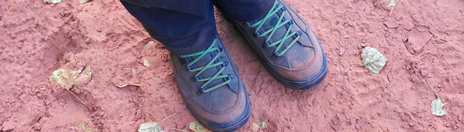
We stopped at Coast Mountain Sports, for Dan’s sake, but I was the one who found boots that fit me like Cinderella’s slippers. Mammut. They stopped making the boots that Dan gave me in Reykjavík, Iceland. I wore them out so badly that I had to throw them away before we left King Salmon. And magically, here they were in Whitehorse, Yukon. Fit like a glove. Perfect for podiatry success on the Camino de Santiago in Spain.
We headed out at 12:30 pm as snow began to fall. We attempted to pull off at Miles Canyon, a beautiful viewing spot for the Yukon River. Unfortunately, the road was gated. We found one that wasn’t, but it was too far from the river. We were able to give Kiva a bit of a walk before heading out of Whitehorse.

The heavy snow eventually lifted as we drove windy roads between the mountains.
We stopped for diesel at Johnson’s Crossing Lodge. Beautiful place. They have an inviting eating area with fresh baked goods, ice cream and coffee in addition to breakfast items. There’s a gift shop with handmade items and a beautiful view of the bridge over the Teslin River. There wasn’t a fireplace roaring, but it felt like there was. That kind of place. You wanted to sit down and stay awhile.
Back on the pavement. Almost no traffic. No people. Few off roads. Just us, the white frosted spruce trees, and the curving Alaska Highway.
I notice that Canadians do a lot of road care. Lots of grating things flat. Lots of spread gravel.
One of the challenges of traveling in the Yukon in October is wondering whether or not gas stations, parks, and accommodations will be open or closed. I’ll note ones that I see are open and operating. In Teslin, Nisutlin Trading Post was open today. They have gas and diesel available. The Yukon Motel was also open.
Teslin is a Tlingit village with some interesting looking museums honoring this heritage along with some Tlingit wood works. Unfortunately, they are closed after September.
Just outside of Teslin, we crossed the longest bridge on the Alaska Highway: Nisutlin Bay Bridge. It crosses Teslin Lake.
We dipped into British Columbia for sixty or so kilometers and were greeted with a sign:
Super, Natural British Columbia
Welcomes You
We stopped briefly at the Continental Divide at 3 pm. There was nothing to see.
The road was tough to drive. Winding, driving snow right at freezing temperatures, wind. Dan said that Nzou was the right name for the truck. Elephants go wherever they want. And she’s taken us wherever we’ve wanted to go. In Africa, nothing stands in an elephant’s way for long.
We reached Nugget City, Yukon just before the turn off to the Cassiar Highway. It was 4:30 pm. We thought about staying for the night at the local motel and having dinner at the restaurant. Both were open. We decided instead to take the risk and continue on toward Dease Lake.
There was a friendly gas station attendant at the start of the highway and he gave us some cautions about the road ahead.
The first thing we noticed about the Cassiar Highway was that it was a very narrow road. The landscape was mystical and flat at first with charred trees as remnants of forest fires. The road became windy and harrowing as it passed into the Cassiar Mountains. There were lakes and parks everywhere. It was beautiful. We passed Centerville where a 72 ounce gold nugget was discovered in 1877 and 3,000 gold miners once lived. Soon after, we passed Jade City, the place that provides most of the world’s supply of jade. Years ago, I had visited the store and was amazed by the impressive items made of jade. One of the disadvantages of the off season is not getting to pass through when everything is open.
As darkness began to set in and the road narrowed and twisted even more as it followed the long Dease Lake, we became concerned about finding a place to stay for the night.
I was imagining where we might camp, but was concerned about setting camp in the dark.
We pulled up to Northway Motor Inn in Dease Lake. The minute I opened the door, I realized that this was a class act hotel in the middle of nowhere! Not a fancy hotel, but very professional, very warm and inviting, very clean, and certainly bustling with activity. The woman at the front desk said that there was a mining conference and there was a hunting gathering in the area as well, so most accommodations were booked up and they had no vacancies. It looked like camping in the dark was in our future.
The woman stopped me as I headed back to the truck. Fortunately, the man overseeing the mining conference had booked more rooms than were needed and there was a room available. Whew! We were quickly set up and she even gave Kiva a dog treat.
There was no open restaurant. The only place to get food was an outdoor vendor a little bit down the road. The Shack. We approached the front window and it reminded me of a booth at a fair. The radio was blasting out and it was intriguing to hear Canadian news and music. Felt homey. And Dan had the best hamburger he’s had in his life. I took a bite and agree. What is put into the food we eat in the United States anyway? I had fish and chips and relished in the fresh flavors from a place that does not reuse its oil for a week like Eddie’s does in King Salmon. It tasted so wonderful and warm. We ate it outside at 32 degrees Fahrenheit over an iced over picnic table and looked up at the stars.
Back at the hotel, the room was peaceful, clean and just what we needed after a long day on the road. Dan drove for seven hours (405 miles) in some challenging conditions and quickly fell asleep.
Urban to wilderness in one day.


TOTEMS OF THE CLANS
Thursday, October 19, 2017

We woke in room 112 of Northway Motor Inn. The light came up on a gray day in Dease Lake, population 303. They have a school, a college, a repair shop. The store and gas station across the way is huge and had anything a person could need. It was much more stocked than the AC and even Naknek Trading in King Salmon/Naknek at much lower prices. We ate breakfast at the deli: english muffin egg sandwiches and rich flavored coffee. Other locals ate there, too, and chatted about the weather at the long tables full of baskets of condiments and jams and syrups. One of the locals offered this simple wisdom: the only thing for sure about winter was that it would get dark.
It began to snow just as we were back on the Cassiar Highway. As the road wound and turned from higher to lower elevations, the precipitation changed from snow to rain and back to snow again. Fall to winter, winter to fall. Yellow, orange and red leaves on the trees and even green leaves and grass. Then, bare trees and snow on the ground.

There were sections of the Cassiar that reminded me of the rainforest of Southeast Alaska. Highway 37A starts at Meziadin Junction and continues just 40 miles west to Hyder, Alaska, just over the border. It’s advertised as one of the most scenic driving routes in North America with numerous glaciers and waterfalls.
We stopped at the village of Gitanyow, which means “people of many numbers.” Very quiet, houses were shack-like. Next to the gas station/store were about a dozen totem poles. The cedar monuments indicated the owner’s clan status and inherited family traditions.
We stopped again just twenty kilometers down the highway at Kitwanga to learn about the Gitwangak warrior chief ‘Nekt. Kitwanga means “the place of the rabbit.”
We arrived in New Hazelton at 5:30 pm. We had a campsite in mind, but the wet, cool weather convinced us to seek a motel instead. Fortunately, we found Robbers Roost Motel. The owner greeted us warmly. There was a small park nearby for Kiva to run around and jump and flip for her frisbee. The town is small and peaceful with beautiful mountains looming overhead. The rain stopped and the evening felt warm, so we walked along the Yellowhead Highway to a place for dinner.
With the Cassiar Highway section complete, we looked forward to traveling on the Yellowhead Highway the next day toward the city of Prince George.


The woman at the front desk said that the only place open for food was The Shack (little white building on the left). Dan had the best hamburger of his life and I enjoyed fresh tasting fish and chips while we gazed at the stars from an iced over white picnic table.

In what seemed to us like the middle of nowhere, there was a huge store with fresh produce. And the prices seemed low after our years in what may be one of the most expensive places in the world.


The famous Gitwangak warrior chief ‘Nekt chose this hill as a stronghold. He led a series of raids against neighboring tribes from this base. He sometimes rolled logs down this hill to ward off assailants.


PEOPLE OF THE RIVER OF MIST
Friday, October 20, 2017


A line of decorated buildings and totem poles looked out at the meeting of the Skeena and Bulkley Rivers at ‘Ksan Historical Village and Museum in Hazelton, British Columbia. The museum and buildings were closed for the season, so we remained outside, gazing at the intriguing carvings and paintings of the Gitxsan people on the site of the ancient village of Gitanmaax. Gitanmaax was an important fishing and transportation hub.
“Git” means “people of” and “xsan” means “the river of mist.” There are an estimated 5,000 Gitxsan in British Columbia today and evidence suggests they have lived in the area around the Skeena and Bulkley Rivers for over 10,000 years. The people of the river of mist are matrilineal with Frog, Eagle, Wolf, and Fireweed Clans. Each clan has independent Houses, Wilp, and each House has a High Chief. The Gitxsan must marry outside of their clan.
There is a campground at ‘Ksan that looks absolutely beautiful. If it had not been raining, we would have camped there. It appeared to be open in mid-October.
We drove to the site of Gitanmaax after a delicious breakfast at Tasty’s, a Chinese restaurant serving traditional breakfast fare along with mystical Chinese music, and turned at the train bridge to cross the Bulkley River at Hagwilget Canyon Bridge. Dan commented that it was a long, steep way down to the shallow running green waters below.
Hagwilget is the name of the community of Wet’suwet’en people on the lower Bulkley River east of Hazelton. The word “Hagwilget” means either “well-dressed” in a showy way or “the quiet people.”
We drove through the Old Town of Hazelton. Established in 1866, there was a little river sternwheeler and old saloon style buildings reflecting the frontier age. Many of the old buildings are still in use today as homes. From 1886 to 1913, Hazelton was the commercial center of the northwest and the upriver terminus for sternwheelers on the Skeena River, enabling supplies to reach mines, farms and settlements in the area.
The tone of Hazelton, new and old, is humble, not extravagant or showy. Simple, honest, clean living.
We drove out of the Hazelton area at 1:20 pm and headed east on the Yellowhead Highway.
Woodstoves streamed white smoke from the tops of slant-roofed houses. Horses, cows and deer grazed at intervals along the drive. We followed a logging truck for about 20 kilometers in the rain. There were many lumber mills.
Smithers, a town for all seasons, said the wooden sign.
Burns Lake looked like a town worth a stop.
At 5 pm, we drove through Vanderhoof, the geographic center of British Columbia.
At 6 pm, we arrived at Bon Voyage Inn, our stop for the night just outside of Prince George.


PRINCE GEORGE TO JASPER

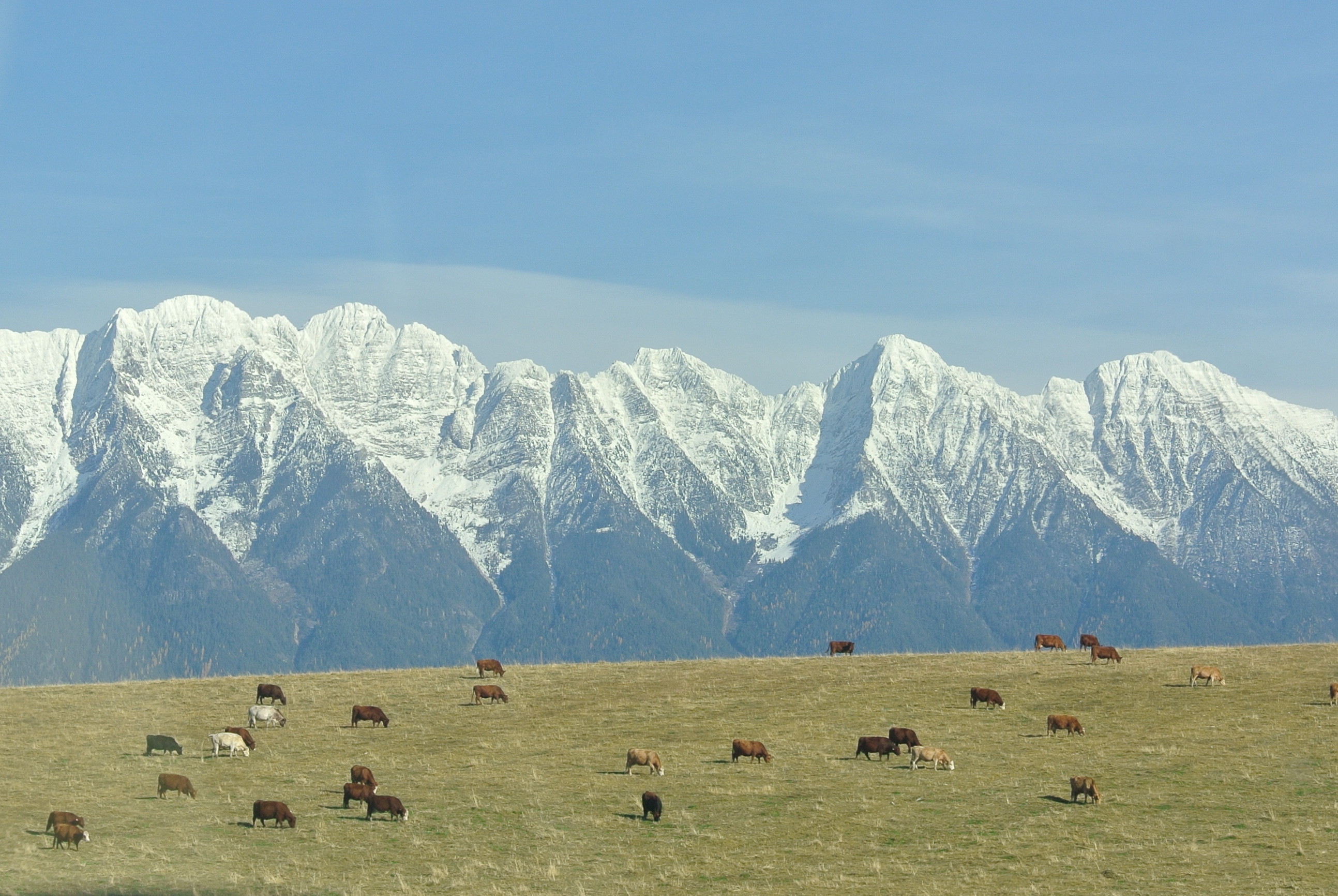
The drive on the Yellowhead Highway to Jasper was stunning, especially with the green and gold of fall.
We woke just outside of Prince George, British Columbia on a sunny, warm morning. Two weeks prior, we flew out of King Salmon. One week prior, we were eating lox and bagels in the oceanview Kresl kitchen in Ninilchik. And now, we were heading to Jasper.
The thick oat smell of the lumber mill greeted us as we returned to the Yellowhead Highway. It wound into Prince George in a way that reminded me of Portland, Oregon. Prince George’s population is roughly 76,000, similar in size and geography to Fairbanks, Alaska, the city where I was born and raised.
The motto for western Canada is “No worries, eh?” or if it isn’t, it could be. I hear it often and it reflects the general attitude of letting life roll and not stressing about things. What is there to stress about with this kind of beauty surrounding you?


JASPER – BRINGER OF TREASURE
Sunday, October 22, 2017
Jasper was the name I wanted for the future violinist born in September 1992. The previous summer I’d seen Jasper National Park in Canada for the first time on the drive from Iowa to Alaska. It was the most beautiful place I could imagine. And carried with the name was the idea of a young man who would enjoy camping and hiking and nature, who would love the outdoors and seek to bring beauty into the world.
The name means “bringer of treasure” and it is believed to be one of the names of the three wisemen from the east.
Zach is thankful that I was the only one who liked Jasper. And he did turn out to be a young man who enjoys the outdoors and who brings beauty into the world.
The past two days, I’ve been in Jasper, Alberta, Canada again. Its beauty is unsurpassed. There are other beautiful places, but I don’t think anyone could say another place is more beautiful.
Jagged mountains with fascinating shapes, deep teal waters, tall dark green trees, limestone canyons. The air is fresh. The elk walk down the main streets. Here are some photographs I took that don’t do it justice.


ICEFIELDS PARKWAY
Monday, October 23, 2017
Go here to find out more about one of the most scenic drives on earth: Icefields Parkway

LEAVING CANADA
Tuesday, October 24, 2017
In Banff, we ate fresh vegetable pizza from the second floor of an old clock tower with views of mountains and the quaint, artistic town below. After dinner, we strolled through shops that stayed open until 10 pm to accommodate the constant flow of visitors.


The next day, we had breakfast at Evelyn’s Coffee Bar, a wonderful place, with a terrific croissant, oatmeal cranberry cookies, and outstanding coffee. We parked in a clean parking garage, the alley exit exuded the aroma of fresh baked bread, and our truck had an outstanding rooftop view. Surprisingly, there was no fee for the parking. If I didn’t feel like I was in Switzerland before, I certainly did at that moment.

We walked along the Bow River and discovered the charming Bow Falls.


Reluctantly, we drove out of Banff and toward Radium Hot Springs. The hot springs pools are right off the road and the town of Radium Hot Springs is friendly and lower key than Banff. We were tempted to stay, but decided to continue toward the Montana border.


We crossed without problem, handing the customs official our passports and Kiva’s rabies record. We decided to stay overnight in Columbia Falls because they had an A&W. We’d seen A&W throughout Canada and we wanted to try one. We stayed in a great motel right across the highway from A&W and walked to our room as the sun set.

